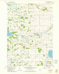
1980 Map of Manchester
USGS Topo · Published 1981About this map
Manchester and Kingston serve as the primary hubs in this part of Wisconsin, where the Grand River and Fox River wind through a landscape defined by glacial lakes and agricultural persistence. The map is punctuated by several small burial grounds essential for family history research, including Lake Maria Cem and the Krastetter Cem near the southern boundary. A notable geographic feature is the Old Indian Treaty Boundary cutting across the northwest corner near Puckaway Lake, a vestige of early nineteenth-century land partitions.
Find a feature on this map
53 named features on this map. Tap any name to fly to it.
Don’t see what you’re looking for? This feature index may not catch every label — zoom into the map to look around manually.
Map Details
Editions of this 1980 Manchester Map
This is the sole edition of this map. No revisions or reprints were ever made.
Other maps of this area

1915 · Neshkoro
USGS Topo · 1:48,000

1916 · Ripon
USGS Topo · 1:48,000

1918 · Neshkoro
USGS Topo · 1:62,500

1918 · Ripon
USGS Topo · 1:62,500

1955 · Randolph
USGS Topo · 1:62,500

1955 · Fox Lake
USGS Topo · 1:62,500

1956 · Ripon
USGS Topo · 1:62,500

1957 · Madison
USGS Topo · 1:250,000

1960 · Madison
USGS Topo · 1:250,000

1963 · Neshkoro
USGS Topo · 1:62,500