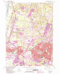
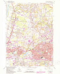
1963 Map of Manchester
USGS Topo · Published 1992About this map
The Hockanum River and Scantic River systems define the industrial and residential geography of this region, which was undergoing significant urban expansion by the late 20th century. While the Connecticut River forms the western boundary, the interior is shaped by historic settlements like East Windsor Hill and Wapping. The map reveals a landscape in transition, where legacy features such as claypits and the Vintons Millpond exist alongside the burgeoning infrastructure of Interstate 84 and Rentschler Airport. Local genealogy and community history are well-represented by numerous sites of worship and burial, including Temple Beth Hillel, St James Cemetery, and Beth Sholom Mem Park. Educational and cultural development is evident through the presence of the Lutz Museum and institutions like East Catholic High Sch. Small streams such as Podunk River and Dry Brook thread through the hills, providing a glimpse of the original drainage patterns before modern suburban development and highway interchanges altered the local terrain.
Find a feature on this map
100 named features on this map. Tap any name to fly to it.
Don’t see what you’re looking for? This feature index may not catch every label — zoom into the map to look around manually.
Map Details
Editions of this 1963 Manchester Map
5 editions found
Other maps of this area

1892 · Hartford
USGS Topo · 1:62,500

1892 · Tolland
USGS Topo · 1:62,500

1892 · Gilead
USGS Topo · 1:62,500

1893 · Middletown
USGS Topo · 1:62,500

1906 · Farmington
USGS Topo · 1:125,000

1921 · Tolland
USGS Topo · 1:62,500

1928 · Windsor Locks
USGS Topo · 1:24,000

1928 · Windsor
USGS Topo · 1:24,000

1928 · Glastonbury
USGS Topo · 1:24,000

1928 · Broad Brook
USGS Topo · 1:24,000