
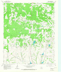
1951 Map of Manchester
USGS Topo · Published 1952About this map
Manchester and the surrounding Red River County countryside are captured here in the early 1950s, revealing a landscape defined by small farming communities and a complex network of waterways. The settlement of Addielou sits centrally, connected by unimproved roads to Kanawha in the northwest. Local life is anchored by rural institutions like Bible Way Ch, Leesville Ch, and the Calhoun Cem.
Find a feature on this map
12 named features on this map. Tap any name to fly to it.
Don’t see what you’re looking for? This feature index may not catch every label — zoom into the map to look around manually.
Map Details
Editions of this 1951 Manchester Map
This is the sole edition of this map. No revisions or reprints were ever made.
Other maps of this area

1951 · Frogville
USGS Topo · 1:24,000

1951 · Millerton
USGS Topo · 1:24,000

1951 · Negley
USGS Topo · 1:24,000

1951 · Kiomatia
USGS Topo · 1:24,000

1951 · Woodland
USGS Topo · 1:24,000

1953 · Texarkana
USGS Topo · 1:250,000

1956 · Texarkana
USGS Topo · 1:250,000

1964 · Detroit
USGS Topo · 1:24,000

1964 · Bagwell
USGS Topo · 1:24,000
1964 · Dimple
USGS Topo · 1:24,000