
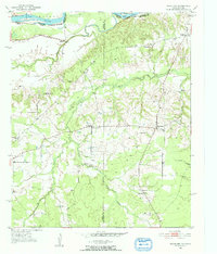
1951 Map of Woodland
USGS Topo · Published 1952About this map
The Red River and Wilson River define the border between Oklahoma and Texas in this early 1950s survey, anchoring a rural landscape of scattered hamlets and creek-side settlements. Small communities like Woodland and Kanawha are the focal points of a region defined by a network of unimproved and light-duty roads connecting family farms to local institutions. The distribution of schools and houses of worship, including Lone Star Sch and Pine Hill Ch, suggests a community-centric social structure typical of the Red River Valley during this era.
Find a feature on this map
25 named features on this map. Tap any name to fly to it.
Don’t see what you’re looking for? This feature index may not catch every label — zoom into the map to look around manually.
Map Details
Editions of this 1951 Woodland Map
2 editions found
Other maps of this area

1951 · Slate Shoals
USGS Topo · 1:24,000

1951 · Frogville
USGS Topo · 1:24,000

1951 · Shoals
USGS Topo · 1:24,000

1951 · Kiomatia
USGS Topo · 1:24,000

1951 · Manchester
USGS Topo · 1:24,000

1953 · Texarkana
USGS Topo · 1:250,000

1956 · Texarkana
USGS Topo · 1:250,000

1964 · Detroit
USGS Topo · 1:24,000

1964 · Bagwell
USGS Topo · 1:24,000

1964 · Blossom
USGS Topo · 1:24,000