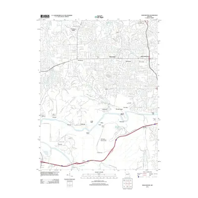
2012 Map of Manchester
USGS Topo · Published 2012About this map
The Meramec River winds through the southern portion of this landscape, carving a distinct border between the suburban development of the north and the wooded research and conservation areas to the south. In this 2012 snapshot, the rapid growth of communities like Ballwin, Ellisville, and Manchester is evident in the dense network of residential streets and shopping centers, including The Lamp and Lantern Village. This modern infrastructure contrasts sharply with the nearby Washington University Tyson Research Center and the hollows that descend toward the riverbank.
Find a feature on this map
53 named features on this map. Tap any name to fly to it.
Don’t see what you’re looking for? This feature index may not catch every label — zoom into the map to look around manually.
Map Details
Editions of this 2012 Manchester Map
This is the sole edition of this map. No revisions or reprints were ever made.
Other maps of this area

1901 · De Soto
USGS Topo · 1:125,000

1903 · O'Fallon
USGS Topo · 1:125,000

1912 · Kimmswick
USGS Topo · 1:62,500

1916 · Kimmswick
USGS Topo · 1:62,500

1931 · Manchester SE
USGS Topo · 1:24,000

1931 · Pacific NE
USGS Topo · 1:24,000

1932 · Manchester NE
USGS Topo · 1:24,000

1933 · Creve Coeur
USGS Topo · 1:24,000

1933 · Kirkwood
USGS Topo · 1:24,000

1937 · Pacific
USGS Topo · 1:24,000