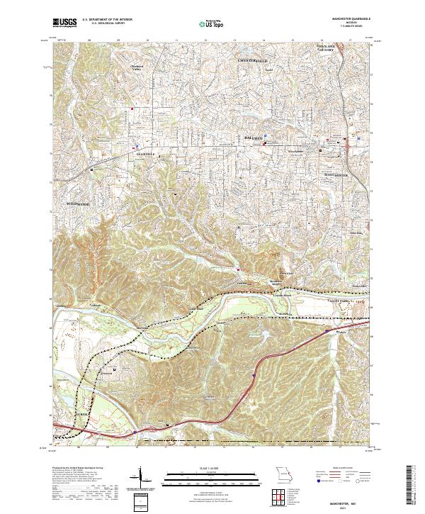
2021 Map of Manchester
USGS Topo · Published 2021About this map
The Meramec River winds through the southern reaches of this landscape, carving a distinct corridor through Rock Hollow and Mincke Hollow. The suburban development of western St. Louis County is evident in the dense networks of Ballwin, Ellisville, and Manchester, which contrast sharply with the preserved green space and rugged relief near Castlewood. Significant local history is preserved in numerous burial grounds, including the Salem United Methodist Cem and the Saint Joseph Parish Cem, marking the early settlement patterns of these communities.
Find a feature on this map
63 named features on this map. Tap any name to fly to it.
Don’t see what you’re looking for? This feature index may not catch every label — zoom into the map to look around manually.
Map Details
Editions of this 2021 Manchester Map
This is the sole edition of this map. No revisions or reprints were ever made.
Other maps of this area

1901 · De Soto
USGS Topo · 1:125,000

1903 · O'Fallon
USGS Topo · 1:125,000

1912 · Kimmswick
USGS Topo · 1:62,500

1916 · Kimmswick
USGS Topo · 1:62,500

1931 · Manchester SE
USGS Topo · 1:24,000

1931 · Pacific NE
USGS Topo · 1:24,000

1932 · Manchester NE
USGS Topo · 1:24,000

1933 · Creve Coeur
USGS Topo · 1:24,000

1933 · Kirkwood
USGS Topo · 1:24,000

1937 · Pacific
USGS Topo · 1:24,000