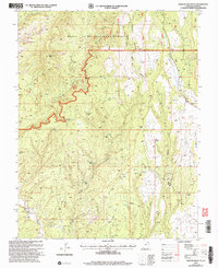
2001 Map of Mancos Jim Butte
USGS Topo · Published 2004About this map
Mancos Jim Butte stands as a prominent landmark in this section of the Manti-La Sal National Forest in San Juan County, Utah. The landscape is defined by its drainage systems, including Dry Wash and the winding Cottonwood Wash, which carve through the high-desert terrain. Evidence of local industry and early land use is scattered throughout, notably at the eastern edge where a Cem and several Gravel Pits are located near Westwater Creek.
Find a feature on this map
19 named features on this map. Tap any name to fly to it.
Don’t see what you’re looking for? This feature index may not catch every label — zoom into the map to look around manually.
Map Details
Editions of this 2001 Mancos Jim Butte Map
This is the sole edition of this map. No revisions or reprints were ever made.
Other maps of this area

1886 · Abajo
USGS Topo · 1:250,000

1892 · Abajo
USGS Topo · 1:250,000

1893 · Abajo
USGS Topo · 1:250,000

1935 · Elk Ridge
USGS Topo · 1:96,000

1940 · Elk Ridge
USGS Topo · 1:125,000

1954 · Elk Ridge 4 NW
USGS Topo · 1:24,000

1954 · Elk Ridge 1 SW
USGS Topo · 1:24,000

1954 · Elk Ridge 1 SE
USGS Topo · 1:24,000
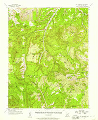
1954 · Mt Linnaeus
USGS Topo · 1:62,500

1956 · Cortez
USGS Topo · 1:250,000