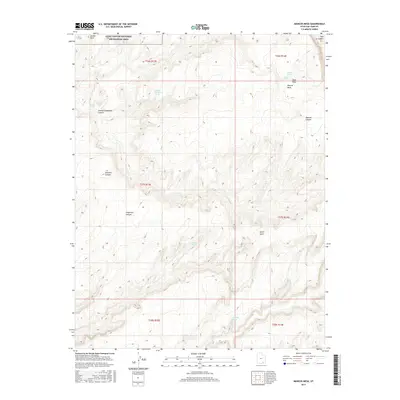
2017 Map of Mancos Mesa
USGS Topo · Published 2017About this map
Mancos Mesa dominates this 2017 high-desert landscape, located within the expansive Glen Canyon National Recreation Area in San Juan County. The terrain is defined by a series of deep drainages and named canyons that incise the mesa, including Knowles Canyon, Forgotten Canyon, and Johnny Coldwater Canyon. Water sources are few and far between in this arid environment, marked by critical points such as Harrison Spring, Secret Spring, and Potato Spring. A notable concentration of landmarks appears in the northeast, where Tator Hole, Potato Hole, and the head of Red Canyon intersect. The map illustrates a landscape shaped by geological erosion, where isolated features like Jacobs Rock and the winding North Gulch provide the only navigational references across the high plateau.
Find a feature on this map
24 named features on this map. Tap any name to fly to it.
Don’t see what you’re looking for? This feature index may not catch every label — zoom into the map to look around manually.
Map Details
Editions of this 2017 Mancos Mesa Map
This is the sole edition of this map. No revisions or reprints were ever made.
Other maps of this area

1886 · Henry Mountains
USGS Topo · 1:250,000

1892 · Henry Mountains
USGS Topo · 1:250,000

1952 · Mancos Mesa
USGS Topo · 1:62,500

1953 · Mt Pennell 4 NE
USGS Topo · 1:24,000

1953 · Lake Canyon
USGS Topo · 1:62,500

1953 · Mt. Ellsworth
USGS Topo · 1:62,500

1954 · White Canyon 3 SE
USGS Topo · 1:24,000

1954 · White Canyon 3 NW
USGS Topo · 1:24,000

1954 · White Canyon 3 NE
USGS Topo · 1:24,000

1954 · White Canyon 3 SW
USGS Topo · 1:24,000