
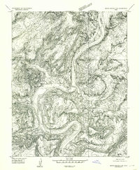
1954 Map of White Canyon 3 NE
USGS Topo · Published 1954About this map
White Canyon dominates this 1950s preliminary survey of the San Juan County plateau, revealing a landscape defined by deep erosional drainages and the early infrastructure of the uranium boom. The primitive route of Highway 95 threads through the canyon system, providing a vital connection to Ducker Crossing. Geologists and mining historians can find evidence of early mineral exploration at a specific mine site located on the cliffs above the main wash. The map also records the precise elevation control points of the era, such as Vabm 6411 and Vabm 5930, while detailing the complex branching of Short Canyon and Blue Canyon before this remote territory was fully integrated into the 15-minute topographic series.
Find a feature on this map
12 named features on this map. Tap any name to fly to it.
Don’t see what you’re looking for? This feature index may not catch every label — zoom into the map to look around manually.
Map Details
Editions of this 1954 White Canyon 3 NE Map
This is the sole edition of this map. No revisions or reprints were ever made.
Other maps of this area

1886 · Henry Mountains
USGS Topo · 1:250,000

1892 · Henry Mountains
USGS Topo · 1:250,000

1952 · Mouth of Dark Canyon
USGS Topo · 1:62,500

1952 · Mancos Mesa
USGS Topo · 1:62,500

1952 · Natural Bridges
USGS Topo · 1:62,500

1952 · Hite
USGS Topo · 1:62,500

1954 · White Canyon 3 SE
USGS Topo · 1:24,000

1954 · White Canyon 3 NW
USGS Topo · 1:24,000

1954 · White Canyon 4 SW
USGS Topo · 1:24,000
1954 · White Canyon 2 SW
USGS Topo · 1:24,000