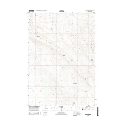
2015 Map of Manderson NE
USGS Topo · Published 2015About this map
Fox Mtn and the long, high spine of Potato Ridge dominate this high-desert portion of Big Horn County. The landscape is defined by an intricate network of drainage systems, including North Sheldon Gulch, South Sheldon Gulch, and the East Fork McDermotts Gulch. These features illustrate the erosion patterns of the Wyoming basin, where intermittent water flow has carved deep relief into the terrain. Red Gulch Rd provides the primary access through this sparsely populated territory, which is divided into sections by the Public Land Survey System as indicated by township and range markings like t52n r91w. The map serves as a precise record of the topography and land management boundaries in the central part of the county at the beginning of the 21st century.
Find a feature on this map
11 named features on this map. Tap any name to fly to it.
Don’t see what you’re looking for? This feature index may not catch every label — zoom into the map to look around manually.
Map Details
Editions of this 2015 Manderson NE Map
This is the sole edition of this map. No revisions or reprints were ever made.
Other maps of this area

1898 · Bald Mountain
USGS Topo · 1:125,000

1901 · Bald Mountain
USGS Topo · 1:125,000

1955 · Sheridan
USGS Topo · 1:250,000

1958 · Sheridan
USGS Topo · 1:250,000

1960 · White Sulphur Spring
USGS Topo · 1:24,000

1960 · Black Mountain
USGS Topo · 1:24,000

1960 · Manderson
USGS Topo · 1:24,000

1960 · Flitner Reservoir
USGS Topo · 1:24,000

1960 · Manderson NE
USGS Topo · 1:24,000

1960 · Devils Kitchen
USGS Topo · 1:24,000