
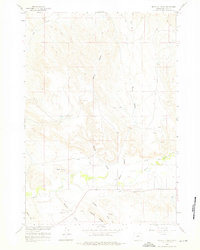
1960 Map of Devils Kitchen
USGS Topo · Published 1962About this map
Devils Kitchen dominates the central landscape of this Wyoming survey, revealing a highly eroded badlands topography north of Shell Creek. The 1960 field checks capture an era of intensive water management for Big Horn County agriculture, illustrated by the complex network of the Shell Canal, Porter Canal, and the Whaley Ditch. An interpretive highlight is the Scharen Thompson Aqueduct, which demonstrates the engineering required to move water across the broken terrain of Potato Draw and Scharen. Industrial activity is evident through numerous claypits and a drill hole scattered across the northern sections, while the presence of Lot 39 indicates specific land divisions near the creek. The map serves as a record of the Missouri River Basin development, showcasing the intersection of natural gulches like Herren Gulch and Porter Gulch with man-made irrigation systems.
Find a feature on this map
18 named features on this map. Tap any name to fly to it.
Don’t see what you’re looking for? This feature index may not catch every label — zoom into the map to look around manually.
Map Details
Editions of this 1960 Devils Kitchen Map
2 editions found
Other maps of this area

1898 · Bald Mountain
USGS Topo · 1:125,000

1901 · Bald Mountain
USGS Topo · 1:125,000

1955 · Cody
USGS Topo · 1:250,000

1955 · Sheridan
USGS Topo · 1:250,000

1958 · Cody
USGS Topo · 1:250,000

1958 · Sheridan
USGS Topo · 1:250,000

1960 · Manderson NE
USGS Topo · 1:24,000

1960 · Shell
USGS Topo · 1:24,000

1960 · Bear Creek Ranch
USGS Topo · 1:24,000

1960 · Wild Horse Flats
USGS Topo · 1:24,000