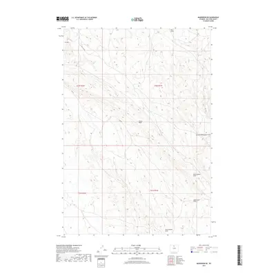
2017 Map of Manderson NE
USGS Topo · Published 2017About this map
Potato Ridge dominates the central landscape of this Big Horn County quadrangle, situated within the Public Land Survey System townships of T52N R91W and T51N R91W. The terrain is defined by a series of dramatic erosional features, including Red Gulch in the north and the complex drainage systems of McDermotts Gulch and North Sheldon Gulch to the east. Transportation through this arid environment is limited to utilitarian routes such as Red Gulch Rd and the appropriately named Haul Rd, which traverse the high ground near Fox Mtn. The map's layout of section lines and range boundaries reflects the systematic division of Wyoming’s open rangeland, where the topography of South Sheldon Gulch and East Fork McDermotts Gulch dictates the movement of water and travelers alike.
Find a feature on this map
13 named features on this map. Tap any name to fly to it.
Don’t see what you’re looking for? This feature index may not catch every label — zoom into the map to look around manually.
Map Details
Editions of this 2017 Manderson NE Map
This is the sole edition of this map. No revisions or reprints were ever made.
Other maps of this area

1898 · Bald Mountain
USGS Topo · 1:125,000

1901 · Bald Mountain
USGS Topo · 1:125,000

1955 · Sheridan
USGS Topo · 1:250,000

1958 · Sheridan
USGS Topo · 1:250,000

1960 · White Sulphur Spring
USGS Topo · 1:24,000

1960 · Black Mountain
USGS Topo · 1:24,000

1960 · Manderson
USGS Topo · 1:24,000

1960 · Flitner Reservoir
USGS Topo · 1:24,000

1960 · Manderson NE
USGS Topo · 1:24,000

1960 · Devils Kitchen
USGS Topo · 1:24,000