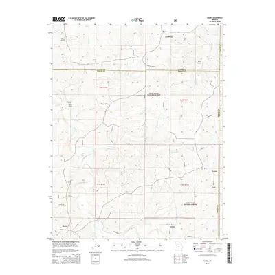
2015 Map of Manes
USGS Topo · Published 2015About this map
Lynchburg and Mingsville anchor this portion of the Ozark plateau, where the landscape is defined by the high ridges of the Mark Twain National Forest. The map reveals a deeply dissected terrain characterized by numerous hollows, including Wilcox Hollow, Wolf Hollow, and Schoolhouse Hollow, which dictate the winding paths of rural roads like Forestry Rd and State Hwy AH.
Find a feature on this map
43 named features on this map. Tap any name to fly to it.
Don’t see what you’re looking for? This feature index may not catch every label — zoom into the map to look around manually.
Map Details
Editions of this 2015 Manes Map
This is the sole edition of this map. No revisions or reprints were ever made.
Other maps of this area

1931 · Manes
USGS Topo · 1:48,000

1941 · Big Piney
USGS Topo · 1:62,500

1941 · Manes
USGS Topo · 1:62,500

1941 · Bado
USGS Topo · 1:62,500

1943 · Big Piney
USGS Topo · 1:62,500

1943 · Manes
USGS Topo · 1:62,500

1943 · Drynob
USGS Topo · 1:62,500

1943 · Bado
USGS Topo · 1:62,500

1954 · Springfield
USGS Topo · 1:250,000

1954 · Drynob
USGS Topo · 1:62,500