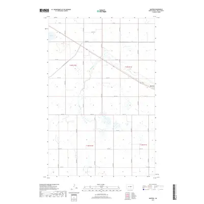
2018 Map of Manfred
USGS Topo · Published 2018About this map
The small settlement of Manfred serves as a focal point in this portion of Wells County, situated along the diagonal path of Co Rd 2. The surrounding landscape is defined by the winding course of the James River, which meanders through a series of section lines and prairie wetlands. This 2018 survey illustrates a highly structured agricultural grid, where long-established section roads like 22nd Ave NE and 18th St NE partition the North Dakota plains. A modern layer of recreational geography is visible through the N Country National Scenic Trail, which cuts across the townships of t149n r72w and t149n r71w. To the west, Egg Lake and various smaller marshes punctuate the terrain, while the alignment of Old Hwy 52 traces the legacy of earlier regional transportation routes through t148n r72w.
Find a feature on this map
20 named features on this map. Tap any name to fly to it.
Don’t see what you’re looking for? This feature index may not catch every label — zoom into the map to look around manually.
Map Details
Editions of this 2018 Manfred Map
This is the sole edition of this map. No revisions or reprints were ever made.
Other maps of this area

1941 · Selz
USGS Topo · 1:62,500

1943 · Maddock
USGS Topo · 1:62,500

1945 · Maddock
USGS Topo · 1:62,500

1945 · Manfred
USGS Topo · 1:62,500

1948 · Fessenden
USGS Topo · 1:62,500

1948 · Manfred
USGS Topo · 1:62,500

1949 · Fessenden SW
USGS Topo · 1:24,000

1949 · Fessenden West
USGS Topo · 1:24,000

1949 · Manfred SW
USGS Topo · 1:24,000

1950 · Manfred SE
USGS Topo · 1:24,000