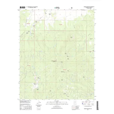
2017 Map of Mangas Mountain
USGS Topo · Published 2017About this map
Mangas Mountain rises as the central landmark of this high-elevation landscape within the Apache National Forest. The map documents a rugged terrain defined by complex drainages and a network of named springs and tanks essential for life in this arid environment. The Continental Divide National Scenic Trail winds through the western half of the quadrangle, crossing numerous canyons such as Green Canyon and Cassidera Canyon. Evidence of localized settlement and land use is present at Caballeriza, while the numerous cattle tanks like Sleeping Steer Tank and Box Canyon Tank indicate the area's grazing history. The topography is further punctuated by peaks like Tub Peak and the larger Mangas Mountains range to the south, with family-named features like Patterson Canyon and Chavez Canyon providing clues to the region's human geography.
Find a feature on this map
67 named features on this map. Tap any name to fly to it.
Don’t see what you’re looking for? This feature index may not catch every label — zoom into the map to look around manually.
Map Details
Editions of this 2017 Mangas Mountain Map
This is the sole edition of this map. No revisions or reprints were ever made.
Other maps of this area

1918 · Pelona
USGS Topo · 1:125,000

1954 · Clifton
USGS Topo · 1:250,000

1954 · Saint Johns
USGS Topo · 1:250,000

1957 · Clifton
USGS Topo · 1:250,000

1957 · Saint Johns
USGS Topo · 1:250,000

1958 · Clifton
USGS Topo · 1:250,000

1958 · Saint Johns
USGS Topo · 1:250,000

1962 · Clifton
USGS Topo · 1:250,000

1962 · Saint Johns
USGS Topo · 1:250,000
1981 · Mangas Mountain
USGS Topo · 1:24,000