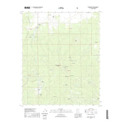
2020 Map of Mangas Mountain
USGS Topo · Published 2020About this map
The high peaks of the Apache National Forest define this 2020 study of the western New Mexico landscape, dominated by the prominent summit of Mangas Mountain. Running the length of the map, the Continental Divide National Scenic Trail traverses a series of ridgelines and deep drainage systems including San Antone Canyon and Cassidera Canyon. The area's reliance on managed water sources is evident through a dense network of mountain springs and catchment systems such as Gallina Spring, Valle Tio Vinces Spring, and Mangas Tank.
Find a feature on this map
66 named features on this map. Tap any name to fly to it.
Don’t see what you’re looking for? This feature index may not catch every label — zoom into the map to look around manually.
Map Details
Editions of this 2020 Mangas Mountain Map
This is the sole edition of this map. No revisions or reprints were ever made.
Other maps of this area

1918 · Pelona
USGS Topo · 1:125,000

1954 · Clifton
USGS Topo · 1:250,000

1954 · Saint Johns
USGS Topo · 1:250,000

1957 · Clifton
USGS Topo · 1:250,000

1957 · Saint Johns
USGS Topo · 1:250,000

1958 · Clifton
USGS Topo · 1:250,000

1958 · Saint Johns
USGS Topo · 1:250,000

1962 · Clifton
USGS Topo · 1:250,000

1962 · Saint Johns
USGS Topo · 1:250,000
1981 · Mangas Mountain
USGS Topo · 1:24,000