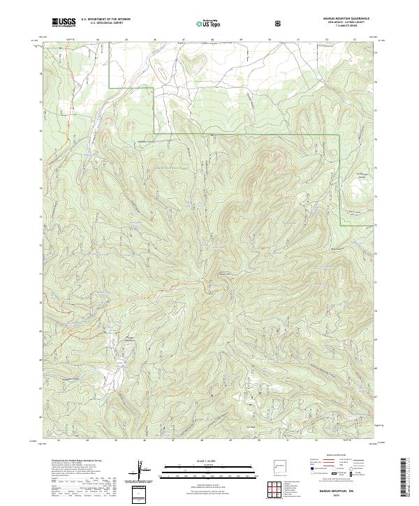
2023 Map of Mangas Mountain
USGS Topo · Published 2023About this map
Mangas Mtn rises as a central landmark within this portion of the Apache National Forest, a landscape defined by its network of high-elevation canyons and vital water sources. The Continental Divide winds through the eastern edge of the quadrangle, traced by the Continental Divide National Scenic Trl. This high-country terrain is punctuated by numerous named springs and tanks, such as Gallina Spring, Bear Well Spring, and Valle Tio Vinces Tank, which supported the livestock and forestry operations of the region. The map reveals a complex drainage system where Mangas Creek and its tributaries, including San Antonio Canyon Mangas Creek, carve through the Mangas Mountains. Historic trails and service roads like the Mangas Spur Trl and Vereda Canyon road provide access to remote features like Tub Peak and Landing Camp Canyon, reflecting the enduring human footprint in this corner of Catron County.
Find a feature on this map
64 named features on this map. Tap any name to fly to it.
Don’t see what you’re looking for? This feature index may not catch every label — zoom into the map to look around manually.
Map Details
Editions of this 2023 Mangas Mountain Map
This is the sole edition of this map. No revisions or reprints were ever made.
Other maps of this area

1918 · Pelona
USGS Topo · 1:125,000

1954 · Clifton
USGS Topo · 1:250,000

1954 · Saint Johns
USGS Topo · 1:250,000

1957 · Clifton
USGS Topo · 1:250,000

1957 · Saint Johns
USGS Topo · 1:250,000

1958 · Clifton
USGS Topo · 1:250,000

1958 · Saint Johns
USGS Topo · 1:250,000

1962 · Clifton
USGS Topo · 1:250,000

1962 · Saint Johns
USGS Topo · 1:250,000
1981 · Mangas Mountain
USGS Topo · 1:24,000