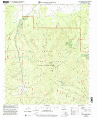
1999 Map of Mangas Mountain
USGS Topo · Published 2002About this map
The Continental Divide weaves across this high-elevation landscape in western New Mexico, marking the transition between the Mangas Mountains and the surrounding high desert drainages. Within the Apache National Forest, the land is etched by a complex network of canyons, including San Antone Canyon and Killion Canyon. The area is defined by its water infrastructure, essential for land management and ranching, featuring numerous named improvements such as the Gabaldon Windmill, Mangas Tank, and Valle Tio Vinces Spring. Human presence is concentrated at the Mangas Work Center and atop Mangas Mountain, where a Lookout and Communication Site occupy the prominent peak. The map reveals the logistical realities of this remote terrain, where 4WD tracks and trails are the primary means of navigating the varied topography of Nester Draw and El Toro Canyon.
Find a feature on this map
70 named features on this map. Tap any name to fly to it.
Don’t see what you’re looking for? This feature index may not catch every label — zoom into the map to look around manually.
Map Details
Editions of this 1999 Mangas Mountain Map
This is the sole edition of this map. No revisions or reprints were ever made.
Other maps of this area

1918 · Pelona
USGS Topo · 1:125,000

1954 · Clifton
USGS Topo · 1:250,000

1954 · Saint Johns
USGS Topo · 1:250,000

1957 · Clifton
USGS Topo · 1:250,000

1957 · Saint Johns
USGS Topo · 1:250,000

1958 · Clifton
USGS Topo · 1:250,000

1958 · Saint Johns
USGS Topo · 1:250,000

1962 · Clifton
USGS Topo · 1:250,000

1962 · Saint Johns
USGS Topo · 1:250,000
1981 · Mangas Mountain
USGS Topo · 1:24,000