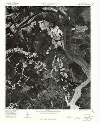
1976 Map of Mangum
USGS Topo · Published 1978About this map
Blewett Falls Lake and the Little Pee Dee River dominate this mid-1970s orthophotoquad, providing a literal photographic record of the North Carolina landscape as it appeared during a time of significant agricultural and forest management. This aerial perspective, prepared by the United States Department of the Interior Geological Survey, reveals the intricate patterns of timber harvesting and farming that surrounded the small communities of Mangum and Ingram. The map captures the interaction between the dense woodlands and the expansive reservoir, reflecting the regional importance of the river system for power and irrigation. This photographic layer offers a clear view of the rural road network and parcel clearings, serving as a primary source for understanding the physical state of the Richmond and Anson county area before subsequent decades of development.
Find a feature on this map
4 named features on this map. Tap any name to fly to it.
Don’t see what you’re looking for? This feature index may not catch every label — zoom into the map to look around manually.
Map Details
Editions of this 1976 Mangum Map
This is the sole edition of this map. No revisions or reprints were ever made.
Other maps of this area

1941 · Spartanburg
USGS Topo · 1:250,000

1942 · Troy
USGS Topo · 1:125,000

1942 · Rockingham
USGS Topo · 1:125,000

1953 · Florence
USGS Topo · 1:250,000

1953 · Raleigh
USGS Topo · 1:250,000

1953 · Spartanburg
USGS Topo · 1:250,000

1953 · Charlotte
USGS Topo · 1:250,000

1954 · Charlotte
USGS Topo · 1:250,000

1954 · Florence
USGS Topo · 1:250,000

1954 · Raleigh
USGS Topo · 1:250,000