
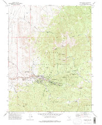
1971 Map of Manhattan
USGS Topo · Published 1974About this map
Manhattan sits at the heart of this Nevada mining landscape, where the Toiyabe Range meets the eastern edge of Smoky Valley. The map documents a town and its surrounding hills heavily marked by early 20th-century silver and gold extraction, with intensive activity concentrated in Manhattan Gulch and across slopes like April Fool Hill and Big Four Hill. Settlement patterns here show the evolution of the district, from the central townsite to the now-vacant North Manhattan (Site) and East Manhattan (Site).
Find a feature on this map
57 named features on this map. Tap any name to fly to it.
Don’t see what you’re looking for? This feature index may not catch every label — zoom into the map to look around manually.
Map Details
Editions of this 1971 Manhattan Map
2 editions found
Other maps of this area

1907 · Tonopah
USGS Topo · 1:250,000

1908 · Tonopah
USGS Topo · 1:250,000

1956 · Tonopah
USGS Topo · 1:250,000

1959 · Tonopah
USGS Topo · 1:250,000

1962 · Tonopah
USGS Topo · 1:250,000

1963 · Baxter Spring
USGS Topo · 1:62,500

1971 · Seyler Peak
USGS Topo · 1:24,000

1971 · Pablo Canyon Ranch
USGS Topo · 1:24,000

1971 · Belmont West
USGS Topo · 1:24,000

1971 · Jefferson
USGS Topo · 1:24,000