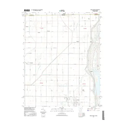
2017 Map of Manila North
USGS Topo · Published 2017About this map
The Little River meanders along the eastern edge of this landscape, defining a wetland corridor marked by distinctive terrain features like Gun Island and Tims Point. This region on the Arkansas-Missouri border is characterized by an extensive network of engineered waterways, including Buffalo Ditch Number 1 and Dredge Boat Creek Ditch Number 12, which enabled the agricultural development of the flat Mississippi River delta. These canals cut through a grid of rural roads and small communities such as Buckeye, Garson, and Arkmo. The southern portion of the map centers on the town of Manila, where the Manila Municipal Airport and street grids of E Olympia Ave represent the primary hub of activity. Local history is further preserved at sites like Box Elder Cem near the state line, serving as a record of the families who settled this fertile, reclaimed bottomland.
Find a feature on this map
70 named features on this map. Tap any name to fly to it.
Don’t see what you’re looking for? This feature index may not catch every label — zoom into the map to look around manually.
Map Details
Editions of this 2017 Manila North Map
This is the sole edition of this map. No revisions or reprints were ever made.
Other maps of this area

1934 · Kennett
USGS Topo · 1:62,500

1940 · Marmaduke
USGS Topo · 1:62,500

1940 · Kennett
USGS Topo · 1:62,500

1941 · Leachville
USGS Topo · 1:62,500

1941 · Manila
USGS Topo · 1:62,500

1953 · Memphis
USGS Topo · 1:250,000

1956 · Leachville
USGS Topo · 1:62,500

1956 · Kennett
USGS Topo · 1:62,500

1956 · Manila
USGS Topo · 1:62,500

1956 · Memphis
USGS Topo · 1:250,000