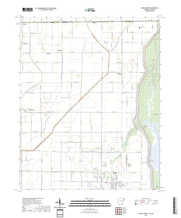
2024 Map of Manila North
USGS Topo · Published 2024About this map
The low-lying Mississippi River Delta landscape of the Arkansas-Missouri border is defined by a complex grid of drainage canals and the expansive protected wetlands of the Big Lake National Wildlife Refuge. The settlement of Manila serves as a local hub, situated just west of the Right Hand Chute Little River and south of its Manila Municipal Airport. This region, part of the historically swampy St. Francis Basin, reveals a highly engineered agricultural environment where named ditches like Buffalo Ditch Number 1 and Honey Cypress Ditch Number 34 channel water through former bottomlands to support the towns of Leachville and Buckeye. To the north, the state line between Missouri and Arkansas cuts through the small communities of Arkmo and Rington. For local historians, the presence of Box Elder Cem and small rail-era hamlets like Boynton, Garson, and Pawheen provide touchpoints for tracing family lineage and the evolution of the area's rural transport network.
Find a feature on this map
100 named features on this map. Tap any name to fly to it.
Don’t see what you’re looking for? This feature index may not catch every label — zoom into the map to look around manually.
Map Details
Editions of this 2024 Manila North Map
This is the sole edition of this map. No revisions or reprints were ever made.
Other maps of this area

1934 · Kennett
USGS Topo · 1:62,500

1940 · Marmaduke
USGS Topo · 1:62,500

1940 · Kennett
USGS Topo · 1:62,500

1941 · Leachville
USGS Topo · 1:62,500

1941 · Manila
USGS Topo · 1:62,500

1953 · Memphis
USGS Topo · 1:250,000

1956 · Leachville
USGS Topo · 1:62,500

1956 · Kennett
USGS Topo · 1:62,500

1956 · Manila
USGS Topo · 1:62,500

1956 · Memphis
USGS Topo · 1:250,000