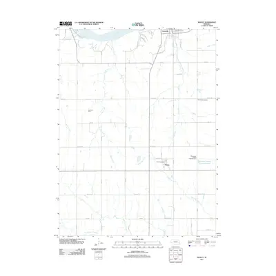
2011 Map of Manley
USGS Topo · Published 2011About this map
The Platte River defines the northern edge of this agricultural landscape in Cass County, where the terrain transitions from river bluffs near Louisville to the rolling fields surrounding the village of Manley. This early 21st-century record of the area highlights the persistent importance of local water management, illustrated by features such as Luetchens Dam and the Midwestern Feeding Company Reservoir. Agricultural infrastructure is further evidenced by the Midwestern Feedlot Retention Dam located just east of the Manley town site.
Find a feature on this map
43 named features on this map. Tap any name to fly to it.
Don’t see what you’re looking for? This feature index may not catch every label — zoom into the map to look around manually.
Map Details
Editions of this 2011 Manley Map
This is the sole edition of this map. No revisions or reprints were ever made.
Other maps of this area

1893 · Fremont
USGS Topo · 1:125,000

1896 · Fremont
USGS Topo · 1:125,000

1903 · Weeping Water
USGS Topo · 1:125,000

1929 · Weeping Water
USGS Topo · 1:125,000

1955 · Fremont
USGS Topo · 1:250,000

1955 · Lincoln
USGS Topo · 1:250,000

1956 · Cedar Creek
USGS Topo · 1:24,000

1956 · Springfield
USGS Topo · 1:24,000
1956 · Weeping Water NE
USGS Topo · 1:24,000

1957 · Fremont
USGS Topo · 1:250,000