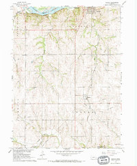
1966 Map of Manley
USGS Topo · Published 1968About this map
The Platte River forms the northern boundary of this central Cass County landscape, where the confluence of riparian lowlands and upland agricultural plateaus defines the local character. In the mid-1960s, the village of Manley sits at the heart of the township, while the larger community of Louisville occupies the bluffs above the river. The region is marked by an intensive transportation and industrial network, featuring three major rail lines—the Chicago and North Western, Chicago Burlington and Quincy, and Missouri Pacific.
Find a feature on this map
31 named features on this map. Tap any name to fly to it.
Don’t see what you’re looking for? This feature index may not catch every label — zoom into the map to look around manually.
Map Details
Editions of this 1966 Manley Map
This is the sole edition of this map. No revisions or reprints were ever made.
Other maps of this area

1893 · Fremont
USGS Topo · 1:125,000

1896 · Fremont
USGS Topo · 1:125,000

1903 · Weeping Water
USGS Topo · 1:125,000

1929 · Weeping Water
USGS Topo · 1:125,000

1955 · Fremont
USGS Topo · 1:250,000

1955 · Lincoln
USGS Topo · 1:250,000

1956 · Cedar Creek
USGS Topo · 1:24,000

1956 · Springfield
USGS Topo · 1:24,000
1956 · Weeping Water NE
USGS Topo · 1:24,000

1957 · Fremont
USGS Topo · 1:250,000