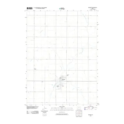
2010 Map of Manning
USGS Topo · Published 2010About this map
Manning serves as the central hub of this agricultural landscape in Carroll County, where the West Nishnabotna River winds through the southwestern plains. The town's infrastructure is well-defined by the Manning Post Office and Manning Municipal Airport, while the surrounding rural township is marked by a grid of local roads like Concord Ave and Birch Ave. Historically significant sites for genealogists include the Sacred Heart Catholic Cemetery, Manning Cemetery, and the Iowa Township Cemetery located further west near Elk Creek. This survey captures the transition of the region's transport network, including the rail-aligned corridor passing through the settlement of Adena. The drainage patterns of Malony Branch and other local waterways illustrate the natural topography that dictated the placement of early homesteads and farmsteads.
Find a feature on this map
35 named features on this map. Tap any name to fly to it.
Don’t see what you’re looking for? This feature index may not catch every label — zoom into the map to look around manually.
Map Details
Editions of this 2010 Manning Map
This is the sole edition of this map. No revisions or reprints were ever made.
Other maps of this area

1954 · Omaha
USGS Topo · 1:250,000

1954 · Fort Dodge
USGS Topo · 1:250,000

1957 · Omaha
USGS Topo · 1:250,000

1957 · Fort Dodge
USGS Topo · 1:250,000

1958 · Omaha
USGS Topo · 1:250,000

1958 · Fort Dodge
USGS Topo · 1:250,000

1971 · Templeton
USGS Topo · 1:24,000

1971 · Gray
USGS Topo · 1:24,000

1978 · Manilla
USGS Topo · 1:24,000

1978 · Irwin
USGS Topo · 1:24,000