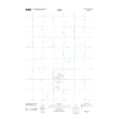
2013 Map of Manning
USGS Topo · Published 2013About this map
The town of Manning serves as the focal point of this western Iowa landscape, where a dense street grid including Main St and Front St meets the rural agricultural sections of Carroll County. The W Nishnabotna River meanders through the terrain, joined by smaller tributaries like Malony Br and Elk Cr. This 2013 survey illustrates the local infrastructure, showing the transition from the concentrated residential and commercial blocks near Railroad St to the sprawling section-line road network that defines the region. To the west, the settlement area of Adena sits along the primary east-west highway corridor. The arrangement of Industrial Dr and various numbered streets reflects the community's modern development around its traditional rail and river geography.
Find a feature on this map
47 named features on this map. Tap any name to fly to it.
Don’t see what you’re looking for? This feature index may not catch every label — zoom into the map to look around manually.
Map Details
Editions of this 2013 Manning Map
This is the sole edition of this map. No revisions or reprints were ever made.
Other maps of this area

1954 · Omaha
USGS Topo · 1:250,000

1954 · Fort Dodge
USGS Topo · 1:250,000

1957 · Omaha
USGS Topo · 1:250,000

1957 · Fort Dodge
USGS Topo · 1:250,000

1958 · Omaha
USGS Topo · 1:250,000

1958 · Fort Dodge
USGS Topo · 1:250,000

1971 · Templeton
USGS Topo · 1:24,000

1971 · Gray
USGS Topo · 1:24,000

1978 · Manilla
USGS Topo · 1:24,000

1978 · Irwin
USGS Topo · 1:24,000