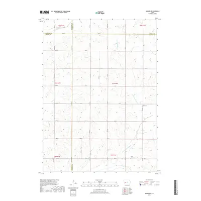
2018 Map of Manning SE
USGS Topo · Published 2018About this map
W Nishnabotna River flows through the northern reaches of this rural landscape, carving a valley through the agricultural heartland where the borders of Crawford, Shelby, Carroll, and Audubon counties converge. The terrain is defined by a dense grid of section lines and secondary roads, reflecting the systematic land division of the Midwest. Small tributaries and drainage branches, including Long Br, Lone Willow Cr, and the E Br W Nishnabotna River, intersect the landscape, highlighting the intricate natural drainage network that supports the region's farms. This area, dominated by open fields and isolated farmsteads, preserves the spatial layout of rural Iowa in the early 21st century, showing how the original Public Land Survey System continues to dictate the local geography.
Find a feature on this map
1 named feature on this map. Tap any name to fly to it.
Don’t see what you’re looking for? This feature index may not catch every label — zoom into the map to look around manually.
Map Details
Editions of this 2018 Manning SE Map
This is the sole edition of this map. No revisions or reprints were ever made.
Other maps of this area

1954 · Omaha
USGS Topo · 1:250,000

1957 · Omaha
USGS Topo · 1:250,000

1957 · Audubon
USGS Topo · 1:62,500

1958 · Omaha
USGS Topo · 1:250,000

1971 · Templeton
USGS Topo · 1:24,000

1971 · Gray
USGS Topo · 1:24,000

1978 · Manilla
USGS Topo · 1:24,000

1978 · Irwin
USGS Topo · 1:24,000

1978 · Kimballton
USGS Topo · 1:24,000

1978 · Manning
USGS Topo · 1:24,000