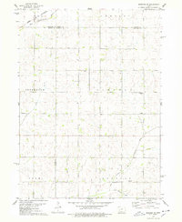
1978 Map of Manning SE
USGS Topo · Published 1978About this map
The West Nishnabotna River and its major tributaries dictate the landscape of this rural Western Iowa intersection in the late 1970s. Spanning the junction of Carroll, Audubon, Shelby, and Crawford counties, the map illustrates a highly organized township system, including portions of Lincoln, Jefferson, Douglas, and Polk. The northwestern corner is defined by the Chicago and North Western rail line as it follows the river valley, a classic example of early Iowa transit corridors. Rural social centers are clearly marked, such as Trinity Ch and the Township Cem in Lincoln Township. The hydrology of the area is particularly detailed, tracing the winding paths of Long Branch, the East Branch West Nishnabotna River, and Lone Willow Creek across the agricultural grid.
Find a feature on this map
16 named features on this map. Tap any name to fly to it.
Don’t see what you’re looking for? This feature index may not catch every label — zoom into the map to look around manually.
Map Details
Editions of this 1978 Manning SE Map
This is the sole edition of this map. No revisions or reprints were ever made.
Other maps of this area

1954 · Omaha
USGS Topo · 1:250,000

1957 · Omaha
USGS Topo · 1:250,000

1957 · Audubon
USGS Topo · 1:62,500

1958 · Omaha
USGS Topo · 1:250,000

1971 · Templeton
USGS Topo · 1:24,000

1971 · Gray
USGS Topo · 1:24,000

1978 · Manilla
USGS Topo · 1:24,000

1978 · Irwin
USGS Topo · 1:24,000

1978 · Kimballton
USGS Topo · 1:24,000

1978 · Manning
USGS Topo · 1:24,000