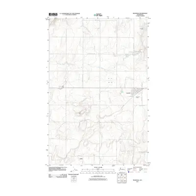
2011 Map of Mansfield
USGS Topo · Published 2011About this map
The town of Mansfield serves as the primary hub of this Douglas County landscape, anchored by a grid of streets including Mansfield Blvd and Railroad Av. The settlement pattern follows the high plateau of the Columbia Basin, where the influence of past rail activity and early 20th-century aviation is evident at the Mansfield Airport. To the south lies Touhey, another named locality that marks the historical transit corridor across this arid expanse.
Find a feature on this map
37 named features on this map. Tap any name to fly to it.
Don’t see what you’re looking for? This feature index may not catch every label — zoom into the map to look around manually.
Map Details
Editions of this 2011 Mansfield Map
This is the sole edition of this map. No revisions or reprints were ever made.
Other maps of this area

1953 · Ritzville
USGS Topo · 1:250,000

1959 · Ritzville
USGS Topo · 1:250,000

1965 · Ritzville
USGS Topo · 1:250,000

1965 · Jameson Lake West
USGS Topo · 1:24,000

1965 · Jameson Lake East
USGS Topo · 1:24,000

1968 · Withrow
USGS Topo · 1:24,000

1968 · Chief Joseph Dam
USGS Topo · 1:24,000

1968 · Wells Dam
USGS Topo · 1:24,000

1968 · Coleman Hill
USGS Topo · 1:24,000
1968 · Mud Spring
USGS Topo · 1:24,000