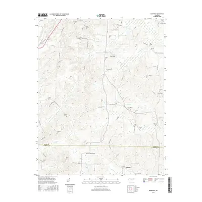
2016 Map of Mansfield
USGS Topo · Published 2016About this map
Mansfield and Routon anchor this rural landscape in the 21st century, where the headwaters of numerous creeks begin their descent through Henry and Carroll counties. The topography is defined by the Tennessee Valley Divide, a prominent ridge that separates the northern-flowing waters of W Sandy Cr and Bomar Cr from the southern drainages like Martin Cr. This map is particularly notable for its dense distribution of family-named cemeteries and small crossroads settlements, reflecting a long history of local lineage and community structure. Small hamlets like Mixie, Ephesus, and Van Dyke are connected by a network of established roads such as the Old McKenzie Hwy and Van Dyke Rd. Genealogy researchers will find significant value in the sheer number of burial sites, including Haglerville Cem, Muzzall Cem, and Hatman Cem, which are scattered throughout the hills and creek bottoms.
Find a feature on this map
95 named features on this map. Tap any name to fly to it.
Don’t see what you’re looking for? This feature index may not catch every label — zoom into the map to look around manually.
Map Details
Editions of this 2016 Mansfield Map
This is the sole edition of this map. No revisions or reprints were ever made.
Other maps of this area

1936 · Mansfield
USGS Topo · 1:24,000

1936 · Vale
USGS Topo · 1:24,000

1936 · Bruceton
USGS Topo · 1:24,000

1936 · Manleyville
USGS Topo · 1:24,000

1936 · Paris
USGS Topo · 1:24,000

1936 · Springville
USGS Topo · 1:24,000

1938 · Springville
USGS Topo · 1:24,000

1940 · Manleyville
USGS Topo · 1:24,000

1941 · Manleyville
USGS Topo · 1:24,000

1950 · Osage
USGS Topo · 1:24,000