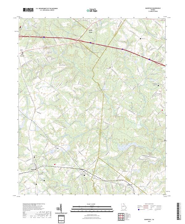
2024 Map of Mansfield
USGS Topo · Published 2024About this map
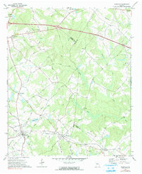
Social Circle and Mansfield anchor this section of the Piedmont where Newton, Walton, Morgan, and Jasper counties converge. The landscape is defined by the winding course of the Little River, which receives numerous tributaries including Nelson Creek, Dennis Creek, and Shoal Creek. Small rural communities like Newborn, Hub Junction, and Broughton are connected by a network of secondary roads such as Keencheefoonee Rd and Co Rte 213, reflecting the region's agricultural roots and persistent settlement patterns.
Find a feature on this map
127 named features on this map. Tap any name to fly to it.
Don’t see what you’re looking for? This feature index may not catch every label — zoom into the map to look around manually.
Map Details
Editions of this 2024 Mansfield Map
This is the sole edition of this map. No revisions or reprints were ever made.