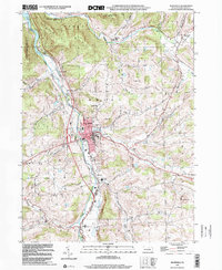
1999 Map of Mansfield
USGS Topo · Published 2001About this map
Mansfield sits at the confluence of the Tioga River and Corey Creek, serving as a central hub for northern Tioga County at the turn of the millennium. The landscape is dominated by the Mansfield University campus and a series of prominent hills, including Oak Hill and Austin Hill. The presence of the Susquehanna Trail running through the valley reflects the long-standing importance of this corridor for regional travel.
Find a feature on this map
39 named features on this map. Tap any name to fly to it.
Don’t see what you’re looking for? This feature index may not catch every label — zoom into the map to look around manually.
Map Details
Editions of this 1999 Mansfield Map
This is the sole edition of this map. No revisions or reprints were ever made.
Other maps of this area

1900 · Tioga
USGS Topo · 1:62,500

1902 · Tioga
USGS Topo · 1:62,500

1925 · Blossburg
USGS Topo · 1:62,500

1927 · Blossburg
USGS Topo · 1:62,500

1931 · Troy
USGS Topo · 1:48,000

1938 · Troy
USGS Topo · 1:62,500

1942 · Canton
USGS Topo · 1:62,500

1944 · Blossburg
USGS Topo · 1:62,500

1944 · Canton
USGS Topo · 1:62,500

1953 · Roseville
USGS Topo · 1:24,000
Featured Places
- Mansfield, PA
- Putnam Township, PA
- Tioga Township, PA
- Lawrence Corners, Rutland Township
- Paisley, Mansfield