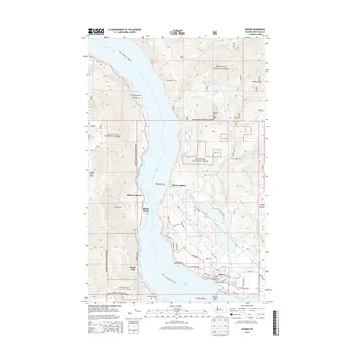
2014 Map of Manson
USGS Topo · Published 2014About this map
Lake Chelan dominates this landscape, serving as a primary corridor for transit and recreation along its steep eastern shores. The Chelan - Lucerne Ferry Crossing route underscores the importance of the water for connecting remote landings like Fields Point Landing and Greens Landing. On the flatter terrain above the lake, the settlement of Manson serves as a focal point for the community, supported by Manson Bay Park and the nearby Manson Ferry Landing.
Find a feature on this map
60 named features on this map. Tap any name to fly to it.
Don’t see what you’re looking for? This feature index may not catch every label — zoom into the map to look around manually.
Map Details
Editions of this 2014 Manson Map
This is the sole edition of this map. No revisions or reprints were ever made.
Other maps of this area

1899 · Methow
USGS Topo · 1:125,000

1901 · Chelan
USGS Topo · 1:125,000

1901 · Methow
USGS Topo · 1:125,000

1955 · Concrete
USGS Topo · 1:250,000

1957 · Wenatchee
USGS Topo · 1:250,000

1958 · Concrete
USGS Topo · 1:250,000

1962 · Concrete
USGS Topo · 1:250,000

1968 · Chelan
USGS Topo · 1:24,000

1968 · South Navarre Peak
USGS Topo · 1:24,000
1968 · Cooper Ridge
USGS Topo · 1:24,000