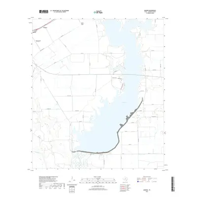
2019 Map of Manson
USGS Topo · Published 2019About this map
Lake Texana dominates the landscape of Jackson County in this survey, where the waters of the Navidad River and Lavaca River converge. The reservoir's eastern shore is defined by a network of local routes including FM 1593 and Brackenridge Pkwy, providing access to shoreline features such as Brackenridge Cem. To the northwest, the settlement of Manson sits near the outskirts of Edna, positioned along the rail corridor. Aviation activity is prominent in the area, marked by the Jackson County Airport, Kubecka Flying Service Inc., and Hahns Airport. In the south, the Red Bluff Cem stands near the confluence of the rivers, while numerous tributaries like Chicolete Cr and Post Oak Br drain the surrounding coastal plains.
Find a feature on this map
48 named features on this map. Tap any name to fly to it.
Don’t see what you’re looking for? This feature index may not catch every label — zoom into the map to look around manually.
Map Details
Editions of this 2019 Manson Map
This is the sole edition of this map. No revisions or reprints were ever made.
Other maps of this area

1952 · Francitas NW
USGS Topo · 1:24,000

1952 · Manson
USGS Topo · 1:24,000

1952 · Edna
USGS Topo · 1:24,000

1952 · La Salle
USGS Topo · 1:24,000

1952 · La Ward
USGS Topo · 1:24,000

1952 · Lolita
USGS Topo · 1:24,000

1953 · Beeville
USGS Topo · 1:250,000

1953 · Seguin
USGS Topo · 1:250,000

1956 · Beeville
USGS Topo · 1:250,000

1958 · Seguin
USGS Topo · 1:250,000