
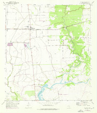
1952 Map of La Ward
USGS Topo · Published 1953About this map
La Ward sits at the center of this coastal prairie landscape, serving as a hub for the agricultural and extractive industries of mid-century Jackson County. The Missouri Pacific railroad cuts a straight line through the settlement, facilitating the movement of local goods near several mapped Oil Wells. The hydrology of the region is defined by the winding paths of West Carancahua Creek and East Carancahua Creek, which converge as they flow toward the head of Carancahua Bay.
Find a feature on this map
11 named features on this map. Tap any name to fly to it.
Don’t see what you’re looking for? This feature index may not catch every label — zoom into the map to look around manually.
Map Details
Editions of this 1952 La Ward Map
2 editions found
Other maps of this area

1952 · Francitas NW
USGS Topo · 1:24,000

1952 · Manson
USGS Topo · 1:24,000

1952 · Point Comfort
USGS Topo · 1:24,000

1952 · Olivia
USGS Topo · 1:24,000

1952 · Turtle Bay
USGS Topo · 1:24,000

1952 · Francitas
USGS Topo · 1:24,000

1952 · Francitas NE
USGS Topo · 1:24,000

1952 · Lolita
USGS Topo · 1:24,000

1953 · Beeville
USGS Topo · 1:250,000

1956 · Beeville
USGS Topo · 1:250,000