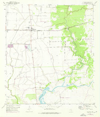
1952 Map of La Ward
USGS Topo · Published 1976About this map
The low-lying coastal prairie of Jackson County centers on the settlement of La Ward in this mid-century survey. Positioned along the Missouri Pacific railroad, the town serves as a focal point for a landscape defined by extensive water management and petrochemical activity. A system of Levees and drainage channels, including Keller Creek and Looney Cr, crisscrosses the flat terrain, protecting agricultural interests from the influence of the nearby Gulf tides.
Find a feature on this map
10 named features on this map. Tap any name to fly to it.
Don’t see what you’re looking for? This feature index may not catch every label — zoom into the map to look around manually.
Map Details
Editions of this 1952 La Ward Map
2 editions found
Other maps of this area

1952 · Francitas NW
USGS Topo · 1:24,000

1952 · Manson
USGS Topo · 1:24,000

1952 · Point Comfort
USGS Topo · 1:24,000

1952 · Olivia
USGS Topo · 1:24,000

1952 · Turtle Bay
USGS Topo · 1:24,000

1952 · Francitas
USGS Topo · 1:24,000

1952 · Francitas NE
USGS Topo · 1:24,000

1952 · La Ward
USGS Topo · 1:24,000

1952 · Lolita
USGS Topo · 1:24,000

1953 · Beeville
USGS Topo · 1:250,000