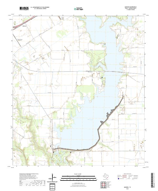
2022 Map of Manson
USGS Topo · Published 2022About this map
Lake Texana dominates the eastern half of this Jackson County landscape, its expansive waters formed by the impoundment of the Navidad River and its various tributaries like Chicolete Cr. The western portion of the map transitions toward the Lavaca River basin, showing a network of rural roads such as Young Rd and Pear Orchard RD that service local agricultural lands and the Jackson County Airport.
Find a feature on this map
52 named features on this map. Tap any name to fly to it.
Don’t see what you’re looking for? This feature index may not catch every label — zoom into the map to look around manually.
Map Details
Editions of this 2022 Manson Map
This is the sole edition of this map. No revisions or reprints were ever made.
Other maps of this area

1952 · Francitas NW
USGS Topo · 1:24,000

1952 · Manson
USGS Topo · 1:24,000

1952 · Edna
USGS Topo · 1:24,000

1952 · La Salle
USGS Topo · 1:24,000

1952 · La Ward
USGS Topo · 1:24,000

1952 · Lolita
USGS Topo · 1:24,000

1953 · Beeville
USGS Topo · 1:250,000

1953 · Seguin
USGS Topo · 1:250,000

1956 · Beeville
USGS Topo · 1:250,000

1958 · Seguin
USGS Topo · 1:250,000