
1972 Map of Mantee
USGS Topo · Published 1974About this map
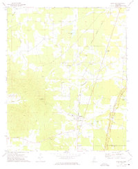
Natchez Trace Parkway cuts a diagonal swath through this Webster County landscape, following the historic path across the Indian Treaty Boundary. The small rail-centered settlements of Mantee and Dancy are captured along the Gulf Central Illinois line, which parallels the parkway through the center of the sheet. The terrain is defined by its drainages, with Line Creek and Old Field Creek carving through the agricultural and wooded sections of the region.
Find a feature on this map
25 named features on this map. Tap any name to fly to it.
Don’t see what you’re looking for? This feature index may not catch every label — zoom into the map to look around manually.
Map Details
Editions of this 1972 Mantee Map
This is the sole edition of this map. No revisions or reprints were ever made.
Other maps of this area

1953 · West Point
USGS Topo · 1:250,000

1958 · West Point
USGS Topo · 1:250,000

1959 · Van Vleet
USGS Topo · 1:62,500

1959 · Pheba
USGS Topo · 1:62,500

1963 · West Point
USGS Topo · 1:250,000

1972 · Maben
USGS Topo · 1:24,000

1972 · Atlanta
USGS Topo · 1:24,000

1972 · Sapa
USGS Topo · 1:24,000

1972 · Hohenlinden
USGS Topo · 1:24,000
1972 · Woodland
USGS Topo · 1:24,000