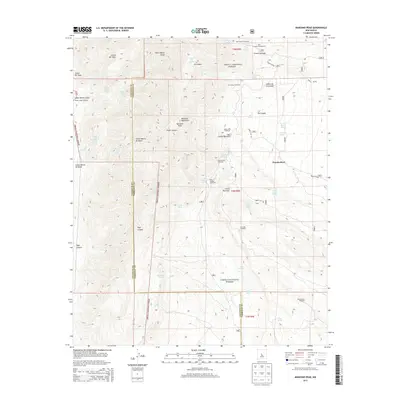
2013 Map of Manzano Peak
USGS Topo · Published 2013About this map
Manzano Peak stands as the high point of this high-elevation landscape within the Cibola National Forest, where the complex drainage systems of the Manzano Mountains define the local geography. Numerous canyons, including Cañon del Sapo, Pipe Canyon, and Cañon Monte Largo, transition from the high ridges down toward the small settlement at Thunderbird. The presence of several springs such as Colorado Spring, Rattlesnake Spring, and Ojo la Cabra highlights the critical water sources that supported early ranching and forestry efforts in this arid environment.
Find a feature on this map
53 named features on this map. Tap any name to fly to it.
Don’t see what you’re looking for? This feature index may not catch every label — zoom into the map to look around manually.
Map Details
Editions of this 2013 Manzano Peak Map
This is the sole edition of this map. No revisions or reprints were ever made.
Other maps of this area

1916 · La Joya
USGS Topo · 1:125,000

1917 · Estancia
USGS Topo · 1:125,000

1952 · Tome SE
USGS Topo · 1:24,000

1952 · Tome NE
USGS Topo · 1:24,000

1952 · Becker
USGS Topo · 1:24,000

1954 · Capilla Peak
USGS Topo · 1:24,000

1954 · Torreon
USGS Topo · 1:24,000

1954 · Torreon
USGS Topo · 1:62,500

1954 · Socorro
USGS Topo · 1:250,000

1958 · Socorro
USGS Topo · 1:250,000