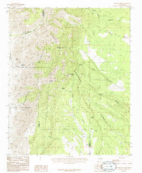
1986 Map of Manzano Peak
USGS Topo · Published 1986About this map
Manzano Peak dominates the high elevation of this 1986 survey, marking a prominent summit within the Manzano Mountains. Located along the boundary between Valencia and Torrance counties, the area is largely contained within the Cibola National Forest. The landscape is defined by a series of steep drainages, including Cañon Colorado, Cañon Priest, and Pipe Canyon. Historical water access is heavily represented by named springs such as Monte Largo Spring, Wild Cow Spring, and Padilla Spring, which likely served as vital resources for early ranching or travel through the mountains.
Find a feature on this map
30 named features on this map. Tap any name to fly to it.
Don’t see what you’re looking for? This feature index may not catch every label — zoom into the map to look around manually.
Map Details
Editions of this 1986 Manzano Peak Map
This is the sole edition of this map. No revisions or reprints were ever made.
Other maps of this area

1916 · La Joya
USGS Topo · 1:125,000

1917 · Estancia
USGS Topo · 1:125,000

1952 · Tome SE
USGS Topo · 1:24,000

1952 · Tome NE
USGS Topo · 1:24,000

1952 · Becker
USGS Topo · 1:24,000

1954 · Capilla Peak
USGS Topo · 1:24,000

1954 · Torreon
USGS Topo · 1:24,000

1954 · Torreon
USGS Topo · 1:62,500

1954 · Socorro
USGS Topo · 1:250,000

1958 · Socorro
USGS Topo · 1:250,000