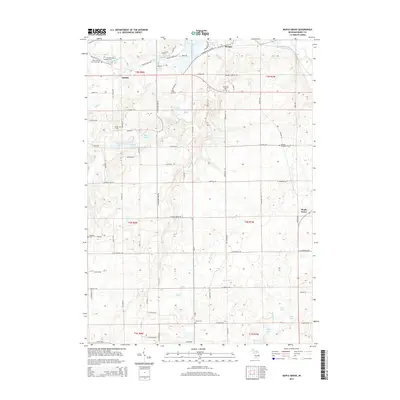
2014 Map of Maple Grove
USGS Topo · Published 2014About this map
The Thornapple River winds through the northern reaches of this Barry County landscape, feeding into the expansive Thornapple Lake near the settlement of Morgan. The terrain is defined by a dense network of glacial water bodies, including Ellison Lake, Gregory Lake, and the clustered Mixer Lake, Middle Lake, and Hall Lake. This 2014 survey reveals a rural infrastructure punctuated by numerous small cemeteries, which offer significant value for genealogical research. Notable sites include the Barry County Poor Farm Cem and Hastings Township Cem in the northwest, alongside the German Evangelical Cem and Barryville Cem further east. The small communities of Quimby and Maple Grove anchor the road network, while several creeks like High Bank Cr and Kellie Cr drain the undulating countryside.
Find a feature on this map
87 named features on this map. Tap any name to fly to it.
Don’t see what you’re looking for? This feature index may not catch every label — zoom into the map to look around manually.
Map Details
Editions of this 2014 Maple Grove Map
This is the sole edition of this map. No revisions or reprints were ever made.
Other maps of this area

1918 · Battle Creek
USGS Topo · 1:62,500

1918 · Galesburg
USGS Topo · 1:62,500

1943 · Battle Creek
USGS Topo · 1:62,500

1944 · Galesburg
USGS Topo · 1:62,500

1947 · Banfield
USGS Topo · 1:24,000

1947 · Bellevue
USGS Topo · 1:24,000

1947 · Bedford
USGS Topo · 1:24,000

1947 · Galesburg
USGS Topo · 1:62,500

1950 · Galesburg
USGS Topo · 1:62,500

1950 · Battle Creek
USGS Topo · 1:62,500
Featured Places
- Baltimore Township, MI
- Johnstown Township, MI
- Castleton Township, MI
- Maple Grove Township, MI
- Quimby, MI