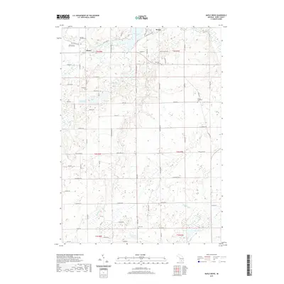
2019 Map of Maple Grove
USGS Topo · Published 2019About this map
The Thornapple River winds through the northern reaches of Barry County, anchoring the small settlements of Quimby and Morgan. This rural landscape is heavily defined by its glacial heritage, dotted with numerous water bodies including Ellison Lake, Long Lake, and Gregory Lake. The southern half of the quadrangle is drained by meandering waterways such as Wabascon Cr and Squaw Brook, illustrating a complex wetland and creek system that dictated early land use and road placement. For genealogists, the map is remarkably dense with burial sites that trace the region's pioneering history, from the Hastings Township Cem and Striker Cem to the German Evangelical Cem. A notable social history landmark is the Barry County Poor Farm Cem, providing a direct link to the county's historical approach to community welfare and rural administration.
Find a feature on this map
76 named features on this map. Tap any name to fly to it.
Don’t see what you’re looking for? This feature index may not catch every label — zoom into the map to look around manually.
Map Details
Editions of this 2019 Maple Grove Map
This is the sole edition of this map. No revisions or reprints were ever made.
Other maps of this area

1918 · Battle Creek
USGS Topo · 1:62,500

1918 · Galesburg
USGS Topo · 1:62,500

1943 · Battle Creek
USGS Topo · 1:62,500

1944 · Galesburg
USGS Topo · 1:62,500

1947 · Banfield
USGS Topo · 1:24,000

1947 · Bellevue
USGS Topo · 1:24,000

1947 · Bedford
USGS Topo · 1:24,000

1947 · Galesburg
USGS Topo · 1:62,500

1950 · Galesburg
USGS Topo · 1:62,500

1950 · Battle Creek
USGS Topo · 1:62,500
Featured Places
- Baltimore Township, MI
- Johnstown Township, MI
- Castleton Township, MI
- Maple Grove Township, MI
- Quimby, MI