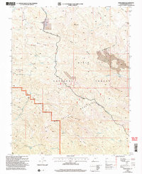
2002 Map of Maple Ridge
USGS Topo · Published 2005About this map
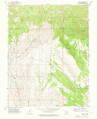
Dixie National Forest dominates this southwestern Utah landscape, where the high ridges of the Bull Valley Mountains meet the western edge of the Pine Valley Mountains. The topography is defined by complex drainage systems, with Moody Wash and Beaver Dam Wash carving deep canyons through the uplifted terrain. Settlement indicators are sparse, centered primarily on the corridor of the Veyo Shoal Creek Road, which traverses the northern section near Grassy Flat. Distinctive geological features like The Pinnacles and high points such as Windy Peak and Ox Valley Peak provide essential landmarks for navigation in this upland environment. The survey also identifies the Pine Valley Mountain Wilderness Boundary, reflecting the area's transition into more protected interior terrain near Cove Mountain.
Find a feature on this map
36 named features on this map. Tap any name to fly to it.
Don’t see what you’re looking for? This feature index may not catch every label — zoom into the map to look around manually.
Map Details
Editions of this 2002 Maple Ridge Map
This is the sole edition of this map. No revisions or reprints were ever made.
Other maps of this area

1885 · St. George
USGS Topo · 1:250,000

1891 · St. George
USGS Topo · 1:250,000

1953 · Cedar City
USGS Topo · 1:250,000

1954 · Gunlock
USGS Topo · 1:24,000

1958 · Cedar City
USGS Topo · 1:250,000

1962 · Cedar City
USGS Topo · 1:250,000
1972 · Gunlock
USGS Topo · 1:24,000
1972 · Goldstrike
USGS Topo · 1:24,000
1972 · Central West
USGS Topo · 1:24,000
1972 · Motoqua
USGS Topo · 1:24,000