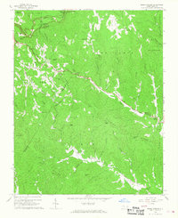
1966 Map of Maple Springs
USGS Topo · Published 1968About this map
The Blue Ridge Parkway winds along the crest of the Blue Ridge in the mid-1960s, marking the intersection of Ashe and Wilkes counties. This mountain landscape is defined by its deep drainages and named ridges, where the headwaters of Stony Fork and the South Prong Lewis Fork carve through the high terrain. The map captures the scattered mountain settlements of Harley and Maple Springs during a period of transition, where established community hubs like Stony Fork Ch and Mountain View Ch serve the rural population.
Find a feature on this map
59 named features on this map. Tap any name to fly to it.
Don’t see what you’re looking for? This feature index may not catch every label — zoom into the map to look around manually.
Map Details
Editions of this 1966 Maple Springs Map
2 editions found
Other maps of this area

1889 · Wilkesboro
USGS Topo · 1:125,000

1891 · Wilkesboro
USGS Topo · 1:125,000

1893 · Cranberry
USGS Topo · 1:125,000

1895 · Cranberry
USGS Topo · 1:125,000

1899 · Cranberry
USGS Topo · 1:125,000

1902 · Cranberry
USGS Topo · 1:125,000

1936 · Blowing Rock
USGS Topo · 1:48,000

1942 · Blowing Rock
USGS Topo · 1:62,500

1953 · Winston-Salem
USGS Topo · 1:250,000

1955 · Winston-Salem
USGS Topo · 1:250,000