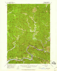
1957 Map of Mapleton
USGS Topo · Published 1959About this map
The Siuslaw River winds through the heart of the Siuslaw National Forest, anchoring a mid-century landscape defined by timber and transport. In the 1950s, the river corridor served as a vital artery for the Southern Pacific railroad, connecting riverfront settlements like Mapleton and Swisshome to the interior. Industrial activity is evident at the sawmill near Gibson Creek and a Quarry south of Bald Mtn, reflecting the era's reliance on local natural resources.
Find a feature on this map
84 named features on this map. Tap any name to fly to it.
Don’t see what you’re looking for? This feature index may not catch every label — zoom into the map to look around manually.
Map Details
Editions of this 1957 Mapleton Map
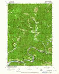
2 editions found
Other maps of this area

1918 · Mapleton
USGS Topo · 1:48,000

1919 · Earl
USGS Topo · 1:48,000

1920 · Siltcoos Lake
USGS Topo · 1:62,500

1920 · Heceta Head
USGS Topo · 1:62,500

1922 · Waldport
USGS Topo · 1:62,500

1940 · Mapleton
USGS Topo · 1:62,500

1941 · Blachly
USGS Topo · 1:62,500

1941 · Siltcoos Lake
USGS Topo · 1:62,500

1942 · Alsea
USGS Topo · 1:62,500

1942 · Blachly
USGS Topo · 1:62,500