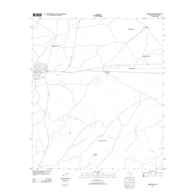
2012 Map of Marathon
USGS Topo · Published 2012About this map
The high desert landscape of the Trans-Pecos is anchored by the community of Marathon, where a grid of streets including N Avenue A and S 6th St transitions into the vast ranching country of Brewster County. This 2012 survey illustrates a classic West Texas settlement pattern, defined by family holdings and named homesteads like Old Beekley Place, Mitchell Place, and the Causey Ranch. These locations reflect the area's long-standing agricultural and pastoral heritage.
Find a feature on this map
21 named features on this map. Tap any name to fly to it.
Don’t see what you’re looking for? This feature index may not catch every label — zoom into the map to look around manually.
Map Details
Editions of this 2012 Marathon Map
This is the sole edition of this map. No revisions or reprints were ever made.
Other maps of this area

1920 · Monument Spring
USGS Topo · 1:62,500

1920 · Marathon
USGS Topo · 1:62,500

1921 · Monument Spring
USGS Topo · 1:62,500

1921 · Marathon
USGS Topo · 1:62,500

1923 · Hess Canyon
USGS Topo · 1:62,500

1923 · Altuda
USGS Topo · 1:62,500

1954 · Fort Stockton
USGS Topo · 1:250,000

1958 · Fort Stockton
USGS Topo · 1:250,000
1967 · Horse Mountain
USGS Topo · 1:24,000

1973 · Fort Stockton
USGS Topo · 1:250,000