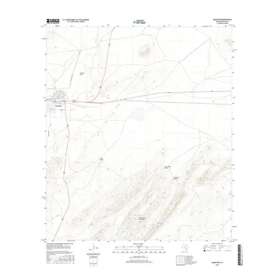
2016 Map of Marathon
USGS Topo · Published 2016About this map
Marathon serves as the focal point of this West Texas landscape, where the town's grid is defined by streets such as N 7th St and SE 1st St. The terrain is characterized by dramatic elevation shifts and drainage systems typical of the region, including Beakley Draw to the north and the prominent Wood Hollow Mountains to the south. Water sources, vital in this arid environment, are mapped at Blanca Springs and along the seasonal paths of Peña Colorada Cr and Peña Blanca Cr. These features, alongside Lake Hollow and Little Wood Hollow, illustrate the complex relationship between the high desert topography and the occasional flow of water. The layout of Airport Rd and Pena Park Rd provides a sense of the local infrastructure supporting this isolated community in the early twenty-first century.
Find a feature on this map
19 named features on this map. Tap any name to fly to it.
Don’t see what you’re looking for? This feature index may not catch every label — zoom into the map to look around manually.
Map Details
Editions of this 2016 Marathon Map
This is the sole edition of this map. No revisions or reprints were ever made.
Other maps of this area

1920 · Monument Spring
USGS Topo · 1:62,500

1920 · Marathon
USGS Topo · 1:62,500

1921 · Monument Spring
USGS Topo · 1:62,500

1921 · Marathon
USGS Topo · 1:62,500

1923 · Hess Canyon
USGS Topo · 1:62,500

1923 · Altuda
USGS Topo · 1:62,500

1954 · Fort Stockton
USGS Topo · 1:250,000

1958 · Fort Stockton
USGS Topo · 1:250,000
1967 · Horse Mountain
USGS Topo · 1:24,000

1973 · Fort Stockton
USGS Topo · 1:250,000