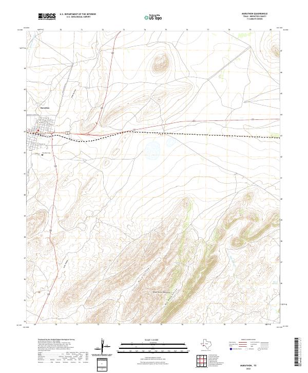
2022 Map of Marathon
USGS Topo · Published 2022About this map
Marathon serves as the central hub of this West Texas landscape, showing a grid of residential streets including Ave D and N 7th St near the intersection of major regional transit routes. The township is framed by the steep topography of the Wood Hollow Mountains to the south, which are dissected by drainage systems like Little Wood Hollow and Big Wood Hollow.
Find a feature on this map
28 named features on this map. Tap any name to fly to it.
Don’t see what you’re looking for? This feature index may not catch every label — zoom into the map to look around manually.
Map Details
Editions of this 2022 Marathon Map
This is the sole edition of this map. No revisions or reprints were ever made.
Other maps of this area

1920 · Monument Spring
USGS Topo · 1:62,500

1920 · Marathon
USGS Topo · 1:62,500

1921 · Monument Spring
USGS Topo · 1:62,500

1921 · Marathon
USGS Topo · 1:62,500

1923 · Hess Canyon
USGS Topo · 1:62,500

1923 · Altuda
USGS Topo · 1:62,500

1954 · Fort Stockton
USGS Topo · 1:250,000

1958 · Fort Stockton
USGS Topo · 1:250,000
1967 · Horse Mountain
USGS Topo · 1:24,000

1973 · Fort Stockton
USGS Topo · 1:250,000