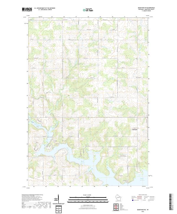
2022 Map of Marathon SW
USGS Topo · Published 2022About this map
The Big Eau Pleine Reservoir dominates the southern landscape of this Marathon County region, where the Big Eau Pleine River enters the expansive impoundment. The terrain is defined by a dense grid of rural roads, many bearing family and descriptive names such as Still Hill Rd, Cedar Hedge Rd, and Schnelle Rd, reflecting the agricultural partition of the land. In the north, the waters of Rocky Run and Burns Cr thread through the township blocks, illustrating the natural drainage patterns that shaped early settlement. This contemporary survey captures the modern road network, including Fairview Rd and Moss Rd, alongside small local landmarks like Maguire Field, providing a precise look at how the central Wisconsin countryside is organized by section lines and natural waterways.
Find a feature on this map
61 named features on this map. Tap any name to fly to it.
Don’t see what you’re looking for? This feature index may not catch every label — zoom into the map to look around manually.
Map Details
Editions of this 2022 Marathon SW Map
This is the sole edition of this map. No revisions or reprints were ever made.
Other maps of this area

1902 · Marathon
USGS Topo · 1:125,000

1953 · Marathon
USGS Topo · 1:48,000

1953 · Stratford
USGS Topo · 1:48,000

1953 · Eau Claire
USGS Topo · 1:250,000

1954 · Marshfield
USGS Topo · 1:62,500

1955 · Green Bay
USGS Topo · 1:250,000

1956 · Milladore
USGS Topo · 1:48,000

1958 · Eau Claire
USGS Topo · 1:250,000

1963 · Marathon
USGS Topo · 1:62,500

1963 · Stratford
USGS Topo · 1:62,500