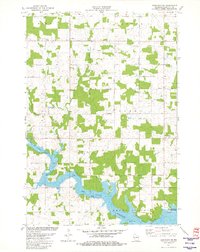
1981 Map of Marathon SW
USGS Topo · Published 1982About this map
The Big Eau Pleine Reservoir dominates the southern landscape of this Marathon County region, fed by the winding course of the Big Eau Pleine River. This 1981 survey illustrates a transition between the organized agriculture of townships like Wien, Cassel, and Emmet and the recreational shoreline of Big Eau Pleine County Park. The northern boundary is marked by the C & N W railroad corridor, while the interior is drained by numerous small waterways including Rocky Run, Burns Creek, and Twin Creek. A rural infrastructure is visible through a network of local roads such as Holstein Lane and Sugar Bush Rd, supporting a mix of wooded woodlots and cleared farmstead tracts. The presence of a Quarry in the western section points to the localized extraction activities that complemented the area's primary agricultural and water-management economy during the early 1980s.
Find a feature on this map
25 named features on this map. Tap any name to fly to it.
Don’t see what you’re looking for? This feature index may not catch every label — zoom into the map to look around manually.
Map Details
Editions of this 1981 Marathon SW Map
This is the sole edition of this map. No revisions or reprints were ever made.
Other maps of this area

1902 · Marathon
USGS Topo · 1:125,000

1953 · Marathon
USGS Topo · 1:48,000

1953 · Stratford
USGS Topo · 1:48,000

1953 · Eau Claire
USGS Topo · 1:250,000

1954 · Marshfield
USGS Topo · 1:62,500

1955 · Green Bay
USGS Topo · 1:250,000

1956 · Milladore
USGS Topo · 1:48,000

1958 · Eau Claire
USGS Topo · 1:250,000

1963 · Marathon
USGS Topo · 1:62,500

1963 · Stratford
USGS Topo · 1:62,500